Our District
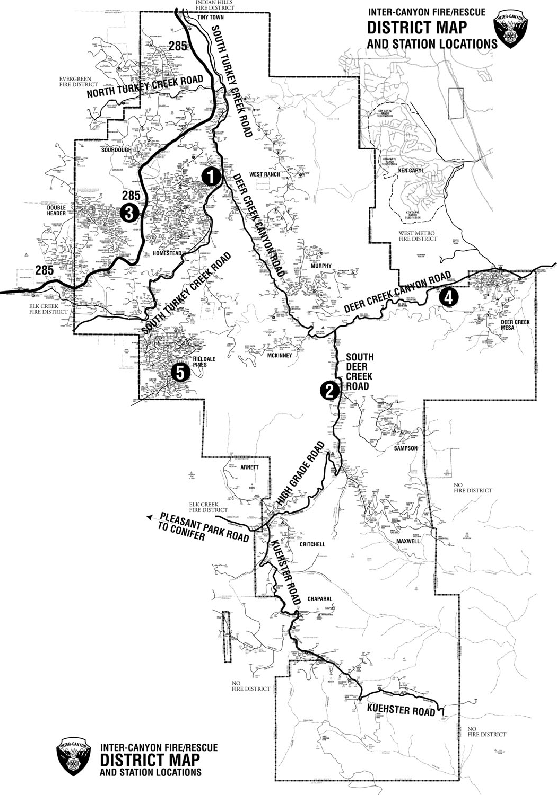
Inter-Canyon Fire Protection District encompasses approximately 55 square miles of varied topography, fuel types and weather conditions. The east edge of our district begins near the first hogback, west of the Ken Caryl subdivision and extends west past State Highway 285. Our northern edge is south of Marshdale and extends south to within a few miles of Waterton Canyon and the South Platte River. Throughout this area we have fuels of grasses, brush, ponderosa and lodge pole pines. We have steep canyons, narrow paved and unpaved roads and many driveways that are not much more than trails. We have subdivisions with hundreds of homes that are clustered on 1-acre lots to homes with driveways approaching a mile in length and hundreds of untouched acres around them. All of these conditions add to the challenges we face when providing our residents with quality fire, rescue and emergency medical services.
Click on a station number for more information.

